India And It’S 7 Land Borders.

May 09, 2019 • 458 views
India is a country in South Asia which is also known as the Republic of India. It is the second(2nd) most populous and seventh (7th) largest country by area. India has varied geographical features with mountains, thick forests, hills, steep valleys, innumerable rivers, vast areas, desert land, fertile areas, drought – hit places, flood – prone areas and so on.
Border Line :-
A border line is a dividing line that marks the territorial limits between two countries. With this seven countries India shares its boundaries including Bhutan, Bangladesh, China, Afghanistan, Myanmar, Nepal, and Pakistan and maritime borders with Sri Lanka, Maldives and Indonesia.
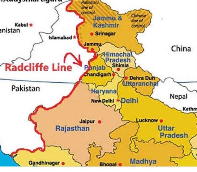
1. India – Pakistan :- Radcliffe Line
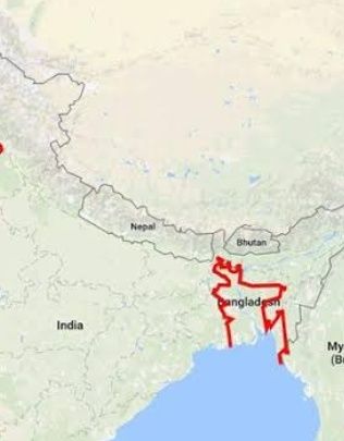
2. India – Bangladesh :- Purbachal (operating zero line)
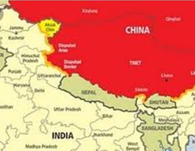
3. India – China :- McMohan Line
4. India – Bhutan :- Indo – Bhutan
5. India – Afghanistan :- Durand Line
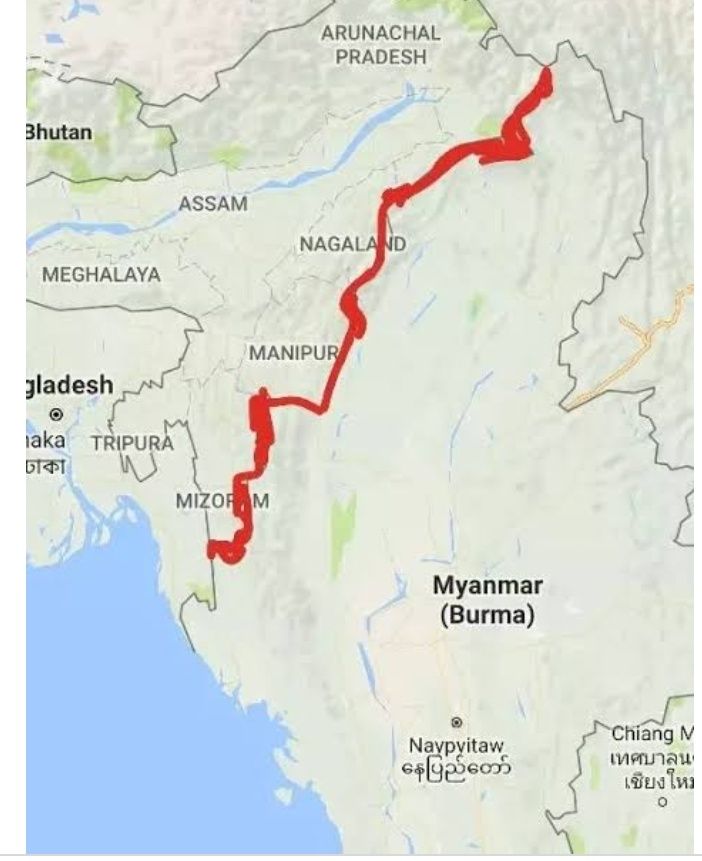
6. India – Myanmar :- Indo – Burma Barrier
7. India – Nepal Border
Radcliffe Line :-
The Radcliffe Line marked the boundary between the two new dominions, named after Sir Cyril Radcliffe, the chairman of the Boundary Commissions. The Radcliffe line was the boundary between India and Pakistan that was announced on August 17, 1947 with 3323 kms.
Purbachal :-
The Purbachal (operating zero – line) with 4096.1 kms was the boundary demarcation line between the India and Bangladesh. A narrow strip known as “Chicken's Neck” is created at the border which made communication and transportation between mainland India and north east India inconvenient.
McMahon Line :-
The demarcation line between the Tibetan region of China and the North-east region of India with 3380 kms is McMahon Line proposed by British colonial administrator Henry McMahon at the 1914 Simla Convention signed between British and Tibetan representatives.
It is named after Henry McMahon, foreign secretary of British India and the chief negotiator of the convention at Simla. It was signed by McMahon and Lonchen Satra.
Indo – Bhutan :-
The Indo – Bhutan is the international boundary between the Kingdom of Bhutan and the Republic of India with 699 Kms.
Durand Line :-
The Durand Line was a frontier boundary between Afghanistan andIndia with 106 kms. After an 1893 memorandum of understanding (MoU) between Mortimer Durand of British India and Afghan Amir Abdur Rahman Khan it is established.

Indo – Burma Barrier :-
The Indo - Burma barrier is a border barrier that India is constructing to seal its 1,624 kms long border with Myanmar.
India – Nepal Border :-
There is no official name for India – Nepal Border. The India–Nepal Border, is an international border which is open and the demarcation line between India and Nepal with 1,758 kms long includes the Himalayan territories as well as Indo-Gangetic Plain.
Recommended

You Are My Soniya Chords - Alka Yagnik & Sonu Nigam - Kabhi Khushi Kabhi Gham